Through water thick with suspended silt, a flathead grey mullet, its scales glinting faintly, nudges a submerged mangrove root. The current, a gentle push of brackish water from the Shatt al-Arab, carries fine particles past its gills, a constant reminder of the river's immense power. Here, in the shallow estuary where the Tigris and Euphrates finally meet the Persian Gulf, sunlight filters weakly, painting the sandy-mud bottom in hues of muted green and brown at a depth of perhaps 3 meters.
Iraq holds only a narrow outlet to the Persian Gulf, yet this small frontage sits at one of the region's most dynamic marine frontiers. The country’s waters are shaped by river discharge, tidal exchange, shallow coastal seas, and intense summer heat. This creates a brackish, sediment-rich environment that favors hardy estuarine and nearshore species, rather than the clear-water coral communities found farther south.
This marine zone has long mattered beyond just its biology. The Shatt al-Arab corridor connected the Tigris and Euphrates basin to Gulf trade for centuries, and its lower reaches have seen repeated conflict, port development, and extensive river modification. This history matters ecologically, as dredging, salinity changes, and altered sediment flow have all influenced habitat quality in the northern Gulf.
For marine explorers, Iraq offers a very different experience from classic tropical diving destinations. Visibility can be poor after river runoff, the seabed is often soft mud or silt, and most underwater life is adapted to turbidity and heat, not clear-water reefs. The reward is a rare look at a Gulf ecosystem where freshwater influence, extreme seasonality, and human history overlap in a compact coastal zone.
Seasonally, the region is far more comfortable in the cooler months. Winter and early spring typically bring milder air and water temperatures, while the summer sea can become exceptionally warm. This seasonal swing strongly shapes the best timing for any scientific survey or field-based marine observation.
Iraq's Coastal Frontier: A Unique Marine Environment
Iraq’s marine territory is dominated by the Shatt al-Arab, the 193-kilometer waterway formed by the Tigris and Euphrates, which empties into the northwestern corner of the Persian Gulf. This riverine input lowers salinity, raises turbidity, and delivers large sediment loads, especially near Basra, Khor Abdullah, and adjacent estuarine channels.
These conditions produce a distinctly stressed but productive coastal ecosystem. Rather than extensive coral formations, the area is characterized by shallow muddy bottoms, tidal flats, creeks, lagoons, and estuarine habitats where fish, shrimp, crabs, and other invertebrates can tolerate rapid changes in salinity and suspended sediment.
Water clarity can fluctuate sharply after seasonal runoff and wind-driven resuspension. In practical terms, that means underwater visibility may be measured in only a few meters on many days, especially close to the river mouth. Slightly clearer conditions can appear farther offshore or during periods of weaker discharge.
Historically, this stretch of coast has been strategically important, sitting beside Iraq’s main access to the sea. The ecological story and the geopolitical story are tightly linked: engineering works, shipping traffic, and upstream water extraction all affect the same coastal system that supports local marine life.
Marine Life of the Northern Persian Gulf
The Iraqi sector of the northern Persian Gulf supports marine life adapted to heat, turbidity, and salinity shifts, rather than to high coral cover. The most common vertebrates and invertebrates in the area are associated with estuaries, shallow lagoons, and soft-bottom habitats. Many of these species belong to the broader Gulf fauna, rather than being strictly endemic to Iraq.
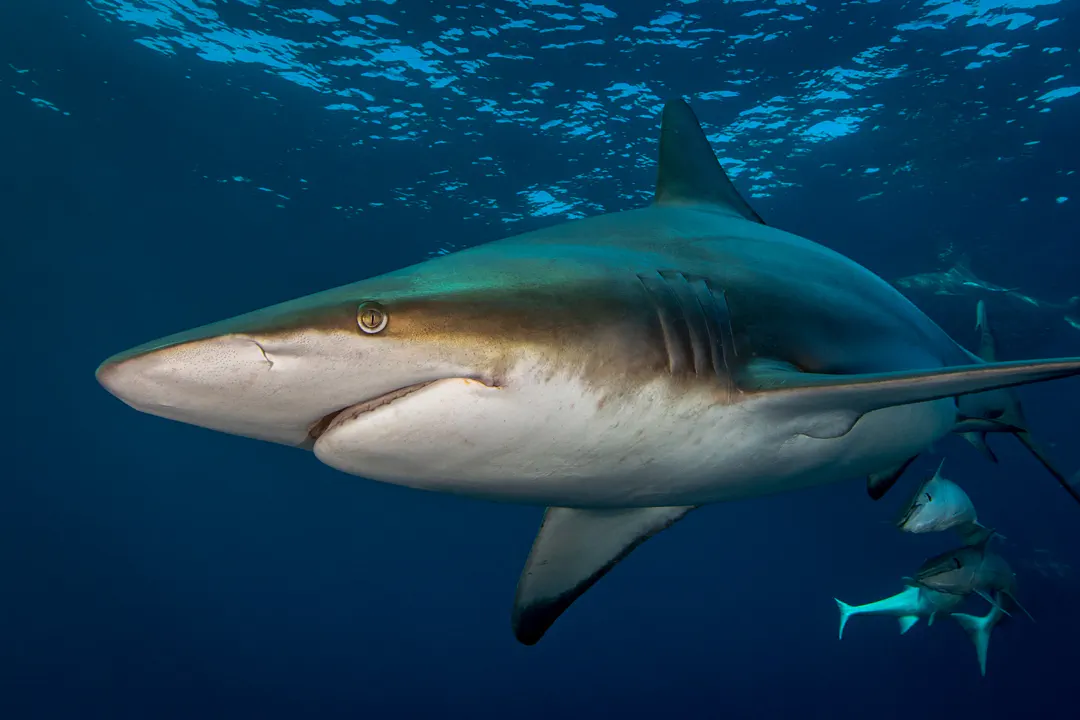
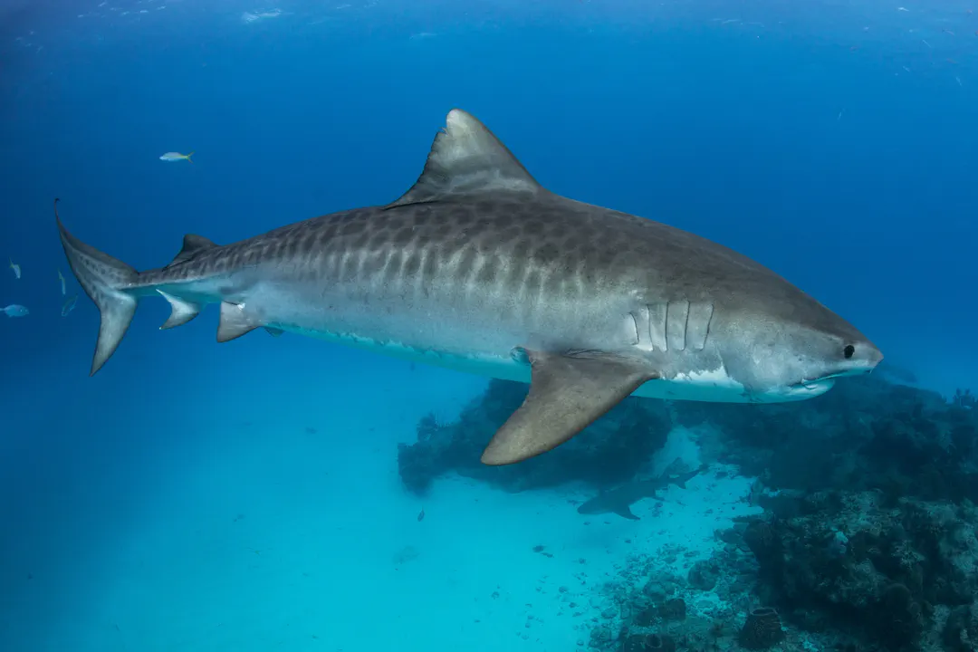
Though large reef systems are not a defining feature of Iraqi waters, the region still supports a diverse food web. Small schooling fish like the Klunzinger's mullet, mullets, and croakers, along with shrimps and swimming crabs, all contribute to the ecosystem. Occasional larger visitors, like the impressive tiger shark or the graceful spinner shark, also traverse these waters.
Because the northern Gulf is extremely warm in summer, many species have physiological limits that shape their seasonal movements. Fish and mobile invertebrates often shift position with changing salinity and temperature. The most heat-tolerant species, however, remain active in very shallow water, where temperatures can rise above 34°C.
For divers or field biologists, the best biological observations usually come from estuarine margins, sheltered creeks, and soft-sediment shallows rather than from reef walls. Those habitats are especially valuable because they concentrate juvenile fish and benthic invertebrates in a compact area.
 © seabook.appAll rights reserved
  © seabook.appAll rights reserved
  © seabook.appAll rights reserved
 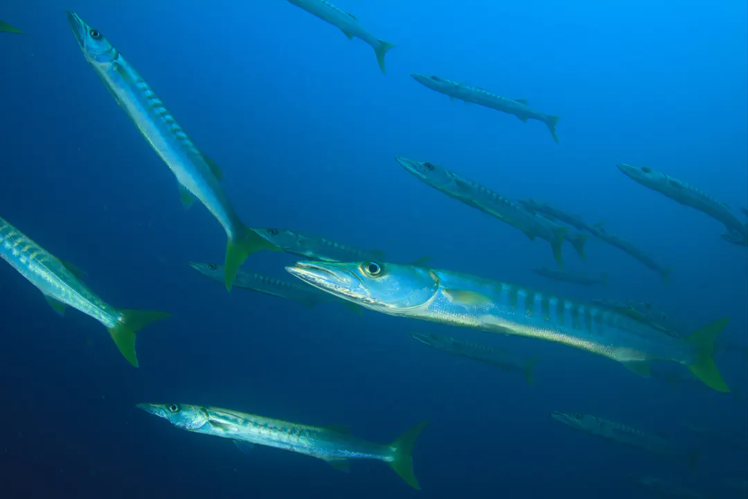 © seabook.appAll rights reserved
 Shallow Coastal Waters & Estuaries
The nearshore waters and estuarine reaches around the Shatt al-Arab are shallow, nutrient-rich, and strongly influenced by runoff. This makes them productive but unstable habitats, with communities dominated by species that can tolerate daily and seasonal changes in salinity, temperature, and sediment load.
Common biological groups in such habitats include mullets like the Klunzinger's mullet, catfish, grunts such as the common silver-biddy, gobies, and various prawns and swimming crabs. These organisms form the base of local fisheries and provide food for larger predators, including rays and occasional sharks that move into the northern Gulf.
From a diving perspective, these are not easy recreational sites. The combination of weak visibility, soft substrates, and variable currents means dives here are better suited to trained scientific teams than to casual visitors. Most fieldwork depends on careful timing with tides and calm weather.
Seasonally, nearshore productivity often peaks when river discharge and nutrient input rise, but that same runoff can make water murkier. In the calmer months, especially late autumn through early spring, the water is usually easier to work in because temperatures are lower and conditions can be slightly more stable.
Potential for Wreck Exploration
The waters off Iraq may contain shipwrecks, port remnants, and other submerged cultural material linked to centuries of river trade, military conflict, and coastal construction. The lower Shatt al-Arab and nearby channels have been strategically important for a long time, so the likelihood of undocumented historic wreckage is real, even if many sites have not been surveyed in detail.
Any wreck exploration in this region would need to account for muddy water, shifting seabeds, and strong legal and heritage considerations. Underwater cultural resources in such a busy maritime corridor can be vulnerable to erosion, dredging, salvage, and navigation works, so archaeological documentation is as important as biological observation.
Shipwrecks can become hard substrate in an otherwise soft-bottom environment. In the Gulf, that often means colonization by barnacles, mussels, algae, and sponges, turning a human-made object into a localized reef-like habitat that can increase biodiversity in the surrounding area, attracting schooling fish.
Because the region is shallow and sediment-laden, sonar and magnetometer surveys are usually more useful than open-water visual search. Divers who work these sites need excellent navigation, low-light equipment, and conservative profiles, since poor visibility and unstable bottom conditions can quickly complicate even shallow inspections.
Best Time to Explore & Conditions
The best time for marine activity in Iraqi waters is generally from late autumn through early spring, roughly November to April, when air temperatures are milder and sea conditions are more manageable. Summer brings extreme heat, and shallow coastal water in the northern Gulf can become hot enough to reduce comfort, shorten bottom time, and stress equipment and crew.
Sea-surface temperatures in Iraq’s coastal waters are typically about 16 to 22°C in winter. They can rise to roughly 29 to 35°C in summer, with very shallow embayments sometimes exceeding that range. The Persian Gulf is famous for some of the highest sea temperatures on Earth, and the northern end where Iraq sits is among the warmest and shallowest parts of the basin.
Visibility varies far more than in oceanic reef destinations. After river discharge, storms, or wind-driven resuspension, suspended sediment can make the water highly opaque. Divers should plan for short, conservative dives and avoid assuming that surface conditions will match underwater conditions.
For fieldwork, the most useful strategy is to time dives around calmer weather, weak tidal exchange, and lower runoff periods. That is especially important because shallow bottoms, soft silt, and limited infrastructure leave little margin for error.
Water temperature
Iraq, monthly average
Basra area in southern Iraq (Persian Gulf coast), typical nearshore surface waters for diving or coastal activities
Practical Considerations for Marine Exploration
Marine exploration in Iraq remains challenging because the country has limited recreational diving infrastructure, few established dive operators, and a coastal zone that is better suited to scientific survey than leisure diving. Security conditions, port restrictions, and environmental variability further narrow the number of locations that can be visited safely and productively.
Logistics matter as much as biology. Field teams need local coordination, reliable boats, emergency planning, and equipment suited to warm, turbid, low-visibility water, including redundant lighting, marker buoys, and strong surface support. In a shallow but sediment-heavy environment, even short excursions can become difficult without disciplined planning.
The region’s greatest research value lies in baseline science. Because the northern Gulf is under-documented compared with better-known reef systems, inventories of fish, benthic invertebrates, water quality, and habitat condition can still produce genuinely useful new information for conservation and fisheries management.
For anyone attempting marine work there, the safest assumption is that conditions can change quickly. Heat, currents, turbidity, and access constraints make this a place where training, permits, and local knowledge are not optional—they are the core of the operation.
Questions
Is recreational diving currently possible in Iraq?
Recreational diving is possible only in a very limited sense, and Iraq does not have a mature dive-tourism industry. Most practical underwater activity is tied to scientific surveys, port-adjacent work, or specialized local expeditions because infrastructure, visibility, and access constraints are significant. Conditions are also highly variable, so any dive requires careful planning and local coordination.
What kind of marine life can be found in Iraqi waters?
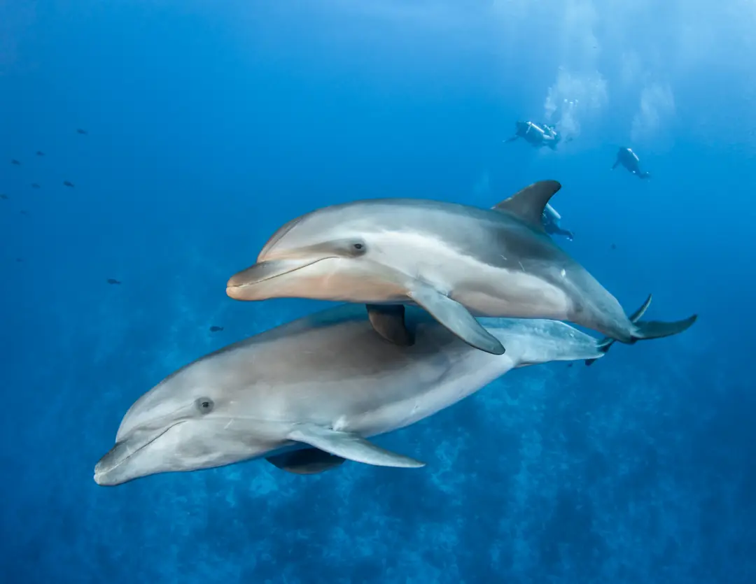
Iraqi waters support estuarine and shallow Gulf species that tolerate warm, turbid, and brackish conditions. Typical life includes mullets, catfish, croakers, shrimps, swimming crabs, mud crabs, and occasional larger visitors such as sharks, rays, and dolphins in the broader northern Gulf.
What are the typical water conditions in the Iraqi Persian Gulf?
Water conditions are usually hot, shallow, and sediment-rich, especially near the Shatt al-Arab mouth. Winter temperatures are often around 16 to 22°C, while summer surface temperatures can reach roughly 29 to 35°C or higher in very shallow embayments. Visibility often drops after runoff or wind-driven sediment resuspension.
Are there any coral reefs in Iraq?
Iraq is not known for extensive coral reef systems, and reef development is limited by high turbidity, large river input, and extreme seasonal heat. Some hard-substrate organisms may occur locally, but the country’s marine habitats are mainly estuarine, muddy, and shallow rather than classic coral reef environments.
What is the main challenge for marine exploration in Iraq?
The main challenge is the combination of limited infrastructure, poor visibility, strong seasonal heat, and access and security constraints. Marine work here usually requires a scientific or specialist approach, with local support, conservative dive planning, and equipment suitable for low-visibility shallow water.